Map - Cat Island, Bahamas (Cat Island)

Cat Island (Cat Island)
Cat Island is located in central Bahamas, and is one of its districts. Cat Island also has the nation's highest point, Mount Alvernia (formerly known as Como Hill). It rises to 63 m and is topped by a monastery called The Hermitage. This assembly of buildings was erected by the Franciscan "Brother Jerome" (John Hawes).

The first white settlers were Loyalists fleeing the American Revolution, who arrived in 1783. The island may have been named after Arthur Catt, a pirate, or the name may refer to its one-time large population of feral cats.

Historically, the island gained wealth from cotton plantations, but slash and burn farming is now the main way of life for Cat Islanders. An economic crop is Croton eluteria (called also cascarilla) bark, which is gathered and shipped to Italy where it becomes a main ingredient in medicines, scents and Campari.

Until written accounts were found, Cat Island was thought to be Guanahani or San Salvador, the first island Christopher Columbus arrived at in the Americas.

 
Map - Cat Island (Cat Island)
Map
Google Earth - Map - Cat Island, Bahamas
Google Earth
Openstreetmap - Map - Cat Island, Bahamas
Openstreetmap
Map - Cat Island - Esri.WorldImagery
Esri.WorldImagery
Map - Cat Island - Esri.WorldStreetMap
Esri.WorldStreetMap
Map - Cat Island - OpenStreetMap.Mapnik
OpenStreetMap.Mapnik
Map - Cat Island - OpenStreetMap.HOT
OpenStreetMap.HOT
Map - Cat Island - CartoDB.Positron
CartoDB.Positron
Map - Cat Island - CartoDB.Voyager
CartoDB.Voyager
Map - Cat Island - OpenMapSurfer.Roads
OpenMapSurfer.Roads
Map - Cat Island - Esri.WorldTopoMap
Esri.WorldTopoMap
Map - Cat Island - Stamen.TonerLite
Stamen.TonerLite
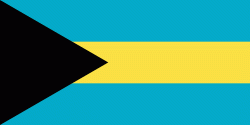
Country - The_Bahamas
The Bahamas, officially the Commonwealth of The Bahamas, is an island country within the Lucayan Archipelago of the West Indies in the North Atlantic. It takes up 97% of the Lucayan Archipelago's land area and is home to 88% of the archipelago's population. The archipelagic state consists of more than 3,000 islands, cays, and islets in the Atlantic Ocean, and is located north of Cuba and northwest of the island of Hispaniola (split between the Dominican Republic and Haiti) and the Turks and Caicos Islands, southeast of the U.S. state of Florida, and east of the Florida Keys. The capital is Nassau on the island of New Providence. The Royal Bahamas Defence Force describes The Bahamas' territory as encompassing 180000 sqmi of ocean space.

The Bahama Islands were inhabited by the Lucayans, a branch of the Arawakan-speaking Taíno, for many centuries. Christopher Columbus was the first European to see the islands, making his first landfall in the "New World" in 1492 when he landed on the island of San Salvador. Later, the Spanish shipped the native Lucayans to and enslaved them on Hispaniola, after which the Bahama islands were mostly deserted from 1513 until 1648, nearly all native Bahamians having been forcibly removed for enslavement or having died of diseases that Europeans brought to the islands. In 1649, English colonists from Bermuda, known as the Eleutheran Adventurers, settled on the island of Eleuthera.
Currency / Language  
ISO Currency Symbol Significant figures
BSD Bahamian dollar $ 2
ISO Language
EN English language
Neighbourhood - Country  
Administrative Subdivision
City, Village,...